
Browse Items (3968 total)
- Collection: Fred Hill Historical Photographs
Sort by:
Baker, Platts Group Map
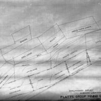
"Baker [County] area mines - Platts Group Map" "Platts Group Mining Claims - Preliminary Survey, Amended Locations - Scale 200' = 1 in. - 1904" Includes latitude and longitude directions.
Baker, Mines Tramway
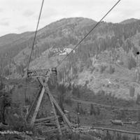
"Baker County [Sumpter, Oregon] area mines, Cracker Creek District - Tramway from North Pole Mines to Mill. Eureka and Excelcior [Excelsior] Mines and Hoist Plant - circa 1901-1903."
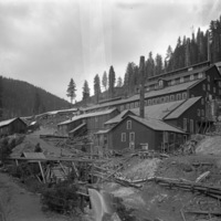
Baker, E and E Mill 1
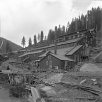
"Baker [County] area mines - E and E Mill" "Eureka and Excelsior Mill and Mines"
Baker, Indiana Co. Mines
"Baker [County] area mines, Sumpter, Oregon - circa 1901-1903 - Copper Mines of the Indiana Mining Company Office Purphyry [periphery?] Dike - Footwall here Ore Vein 400 Ft. wide 20 Ft. Shaft Hoisting Plant Barn Boarding House Hanging Wall Iron Dike…
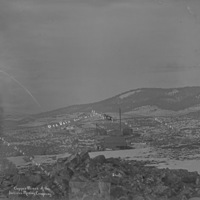
Sumpter, 1900
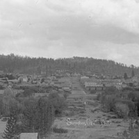
"Sumpter Or. in .... 1900"
Baker, Bonanza Mill
"Baker [County] area [Sumpter, Oregon] mines" "Bonanza Mill - Sept. 25, 1903"
Baker, Buckeye Mines
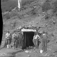
"Baker [County] area mines - Buckeye Mines" "Aug. 15, 1905 - Tunnel No. 1 - Excavating Crew"
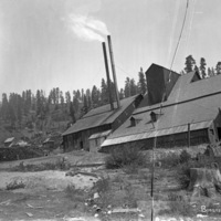
Baker, E and E Mill 2

"Baker [County] area mines - E and E Mill - Cracker Creek Mill" "E and E Mill and Mines - Cracker Creek"
Logging Operation, WA 1
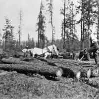
"Thelma Atwood's Originals - Logging - 1926 era - Ford Washington" "Camp J. Ford, Wash."
Baker, E and E Mill 3
"Baker [County] area mines - E and E Mill"