
Bibliographic Data
Title
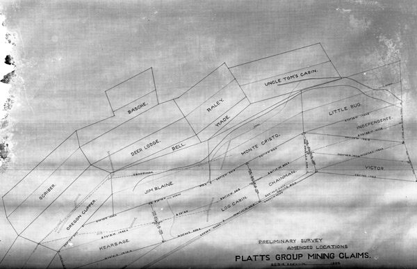
Baker, Platts Group Map
Subject
Land management
Maps
Mines
Survey drawings
Description
"Baker [County] area mines - Platts Group Map" "Platts Group Mining Claims - Preliminary Survey, Amended Locations - Scale 200' = 1 in. - 1904" Includes latitude and longitude directions.
Creator
Anonymous
Date
1904
Rights
(c)Eastern Oregon University. This image is licensed under a Creative Commons Attribution - Noncommercial - No Derivative Works 3.0 United States License (http://creativecommons.org/licenses/by-nc-nd/3.0/us/). Acknowledgement of Eastern Oregon University as a source is required. For print quality images, prints, or high resolution tiff files, or commercial uses please contact the Library Director at Eastern Oregon University.
Identifier
2010.2.2172